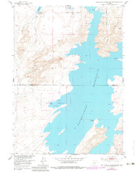
1951 Map of Pathfinder Reservoir NW
USGS Topo · Published 1983About this map
Pathfinder National Wildlife Refuge encompasses a significant portion of this landscape, established as part of the broader development of the Missouri River Basin. The shoreline of Pathfinder Reservoir is the dominant geographic feature, creating a complex network of bays and promontories such as Bishop Point, Woolf Point, and Sand Creek Point. The high desert terrain is defined by dramatic geological formations, most notably the towering Pathfinder Mountain and the expansive Granite Ridge. Straddling the border of Natrona and Carbon Counties, the area shows a distinct contrast between the vast water storage of the reservoir and the arid, drainage-fed valleys like that of Arkansas Creek. The 1951 field data, updated with 1980 aerial revisions, provides an essential record of the shoreline and land use before late-20th-century shifts in the Wyoming backcountry.
Find a feature on this map
11 named features on this map. Tap any name to fly to it.
Don’t see what you’re looking for? This feature index may not catch every label — zoom into the map to look around manually.
Map Details
Editions of this 1951 Pathfinder Reservoir NW Map
3 editions found
Other maps of this area

1951 · Benton Basin SW
USGS Topo · 1:24,000

1951 · Benton Basin
USGS Topo · 1:24,000

1951 · Pathfinder Reservoir NW
USGS Topo · 1:24,000

1951 · Pathfinder Dam
USGS Topo · 1:24,000

1951 · Fort Ridge
USGS Topo · 1:24,000

1953 · Leo
USGS Topo · 1:24,000

1953 · Pathfinder Reservoir SW
USGS Topo · 1:24,000

1953 · Buzzard Ranch
USGS Topo · 1:24,000

1955 · Casper
USGS Topo · 1:250,000

1958 · Casper
USGS Topo · 1:250,000