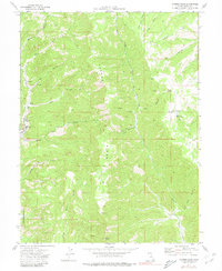
1972 Map of Patmos Head
USGS Topo · Published 1980About this map
Patmos Ridge dominates this Carbon County landscape, where industrial coal mining and rugged ranching history intersect in the early 1970s. The western edge of the map details the infrastructure of the Sunnyside Mine, featuring several Mines and specialized structures like an Air Shaft. The presence of the Upper Sunnyside (Site) and a nearby Rodeo Ground suggests the social and residential footprint of this mining community before shifts in operations.
Find a feature on this map
32 named features on this map. Tap any name to fly to it.
Don’t see what you’re looking for? This feature index may not catch every label — zoom into the map to look around manually.
Map Details
Editions of this 1972 Patmos Head Map
2 editions found
Other maps of this area

1886 · Price River
USGS Topo · 1:250,000

1896 · Price River
USGS Topo · 1:250,000

1915 · Sunnyside
USGS Topo · 1:62,500

1948 · Woodside
USGS Topo · 1:62,500

1949 · Woodside
USGS Topo · 1:62,500

1950 · Woodside
USGS Topo · 1:62,500

1954 · Flat Canyon
USGS Topo · 1:62,500

1954 · Range Creek
USGS Topo · 1:62,500

1956 · Price
USGS Topo · 1:250,000

1960 · Price
USGS Topo · 1:250,000