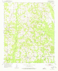
1951 Map of Patmos
USGS Topo · Published 1975About this map
Patmos serves as a central hub in this rural Arkansas landscape, situated along the Kansas City Southern railroad line. The settlement pattern in the early 1950s is defined by a dense network of country churches and family cemeteries, including Macedonia Cem, Huckabee Cem, and Wise Cem. These landmarks, along with local congregations at Old Evening Shade Ch and Hinton Chapel, reveal the close-knit community structure of Hempstead County during this era.
Find a feature on this map
30 named features on this map. Tap any name to fly to it.
Don’t see what you’re looking for? This feature index may not catch every label — zoom into the map to look around manually.
Map Details
Editions of this 1951 Patmos Map
4 editions found
Other maps of this area

1901 · Gurdon
USGS Topo · 1:125,000

1951 · Patmos
USGS Topo · 1:24,000

1951 · Sheppard
USGS Topo · 1:24,000

1951 · Spring Hill
USGS Topo · 1:24,000

1951 · Hope
USGS Topo · 1:24,000

1952 · Old Town
USGS Topo · 1:24,000

1952 · Boyd Hill
USGS Topo · 1:24,000

1953 · El Dorado
USGS Topo · 1:250,000

1957 · El Dorado
USGS Topo · 1:250,000

1958 · El Dorado
USGS Topo · 1:250,000