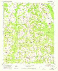
1951 Map of Patmos
USGS Topo · Published 1978About this map
Indian Mounds rise above the drainage of Little Bodcau Creek in this southern Arkansas landscape, where the shifting center of community life is visible in the two distinct locations of Patmos. The original settlement site, noted as Patmos (Old Town), sits south of the newer town center established along the Louisiana and Arkansas railroad line.
Find a feature on this map
27 named features on this map. Tap any name to fly to it.
Don’t see what you’re looking for? This feature index may not catch every label — zoom into the map to look around manually.
Map Details
Editions of this 1951 Patmos Map
4 editions found
Other maps of this area

1901 · Gurdon
USGS Topo · 1:125,000

1951 · Patmos
USGS Topo · 1:24,000

1951 · Sheppard
USGS Topo · 1:24,000

1951 · Spring Hill
USGS Topo · 1:24,000

1951 · Hope
USGS Topo · 1:24,000

1952 · Old Town
USGS Topo · 1:24,000

1952 · Boyd Hill
USGS Topo · 1:24,000

1953 · El Dorado
USGS Topo · 1:250,000

1957 · El Dorado
USGS Topo · 1:250,000

1958 · El Dorado
USGS Topo · 1:250,000