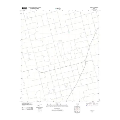
2010 Map of Patricia
USGS Topo · Published 2010About this map
Patricia serves as the central focal point of this West Texas landscape, situated at the junction of several key rural transport arteries. The survey reveals a highly structured grid of section roads and county lanes, such as Co Rd AA and Co Rd 88, which reflect the region’s deep-seated agricultural and ranching organization. The layout is dominated by long, straight stretches of pavement like Ranch Rd 2051 and Ranch Rd 829, illustrating the vast distances between local hubs. Scattered across the plains are numerous small, unnamed water features and depressions, indicating the subtle hydrology of the Llano Estacado. This 2010 edition by the U.S. Geological Survey captures the quiet persistence of these small communities and the enduring physical infrastructure of Dawson County's rural interior.
Find a feature on this map
23 named features on this map. Tap any name to fly to it.
Don’t see what you’re looking for? This feature index may not catch every label — zoom into the map to look around manually.
Map Details
Editions of this 2010 Patricia Map
This is the sole edition of this map. No revisions or reprints were ever made.
Other maps of this area

1954 · Hobbs
USGS Topo · 1:250,000

1954 · Big Spring
USGS Topo · 1:250,000

1958 · Big Spring
USGS Topo · 1:250,000

1958 · Hobbs
USGS Topo · 1:250,000

1966 · Wolcott Ranch
USGS Topo · 1:24,000

1966 · Flower Grove
USGS Topo · 1:24,000

1966 · Scharbauer Ranch
USGS Topo · 1:24,000

1970 · Patricia SW
USGS Topo · 1:24,000

1970 · Patricia
USGS Topo · 1:24,000

1970 · Lamesa South
USGS Topo · 1:24,000