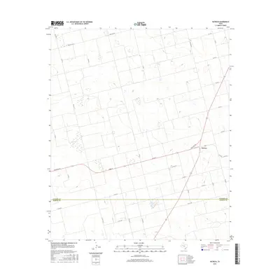
2016 Map of Patricia
USGS Topo · Published 2016About this map
The small community of Patricia sits at the intersection of several key rural routes on the high plains of the Llano Estacado. This 2016 survey illustrates the strictly organized agricultural landscape of West Texas, defined by the boundary between Dawson Co and Martin Co. The map reveals a dense network of county roads, such as Co Rd AA and Co Rd 5100, which provide access to the vast acreage of the surrounding plains. These roads serve the local farming economy, connecting remote homesteads and fields to the primary thoroughfares of Ranch Rd 703 and FM 828 E. Numerous small, seasonal water features dot the terrain, reflecting the unique hydrology of the Southern High Plains where playa lakes are common features of the otherwise flat landscape.
Find a feature on this map
27 named features on this map. Tap any name to fly to it.
Don’t see what you’re looking for? This feature index may not catch every label — zoom into the map to look around manually.
Map Details
Editions of this 2016 Patricia Map
This is the sole edition of this map. No revisions or reprints were ever made.
Other maps of this area

1954 · Hobbs
USGS Topo · 1:250,000

1954 · Big Spring
USGS Topo · 1:250,000

1958 · Big Spring
USGS Topo · 1:250,000

1958 · Hobbs
USGS Topo · 1:250,000

1966 · Wolcott Ranch
USGS Topo · 1:24,000

1966 · Flower Grove
USGS Topo · 1:24,000

1966 · Scharbauer Ranch
USGS Topo · 1:24,000

1970 · Patricia SW
USGS Topo · 1:24,000

1970 · Patricia
USGS Topo · 1:24,000

1970 · Lamesa South
USGS Topo · 1:24,000