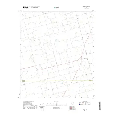
2019 Map of Patricia
USGS Topo · Published 2019About this map
Patricia serves as the central hub of this agricultural landscape in the West Texas plains, situated near the intersection of several key rural routes. The map documents a strictly organized grid of county roads and ranch-to-market passages, reflecting the area's deep-rooted ranching and farming heritage. A prominent boundary between Dawson Co and Martin Co bisects the southern portion of the quadrangle, illustrating the jurisdictional division in this sparsely populated region. The terrain is characterized by numerous small depressions and basins, typical of the Llano Estacado, which collect seasonal water across the high plains. Movement through the territory is facilitated by a network of named routes including Ranch Rd 703 and Ranch Rd 829, which connect the small settlement of Patricia to the surrounding cotton fields and ranch lands.
Find a feature on this map
26 named features on this map. Tap any name to fly to it.
Don’t see what you’re looking for? This feature index may not catch every label — zoom into the map to look around manually.
Map Details
Editions of this 2019 Patricia Map
This is the sole edition of this map. No revisions or reprints were ever made.
Other maps of this area

1954 · Hobbs
USGS Topo · 1:250,000

1954 · Big Spring
USGS Topo · 1:250,000

1958 · Big Spring
USGS Topo · 1:250,000

1958 · Hobbs
USGS Topo · 1:250,000

1966 · Wolcott Ranch
USGS Topo · 1:24,000

1966 · Flower Grove
USGS Topo · 1:24,000

1966 · Scharbauer Ranch
USGS Topo · 1:24,000

1970 · Patricia SW
USGS Topo · 1:24,000

1970 · Patricia
USGS Topo · 1:24,000

1970 · Lamesa South
USGS Topo · 1:24,000