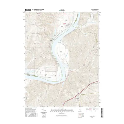
2016 Map of Patriot
USGS Topo · Published 2016About this map
The Ohio River carves a sweeping path through this river-valley landscape, defining the state boundary between Indiana and Kentucky. The Indiana shoreline is marked by distinctive alluvial plains including Mexico Bottom, Steele Bottom, and Egypt Bottom, which have long supported the region's agricultural life. The settlement of Patriot sits prominently on the river bend, serving as a focal point for the surrounding rural uplands.
Find a feature on this map
106 named features on this map. Tap any name to fly to it.
Don’t see what you’re looking for? This feature index may not catch every label — zoom into the map to look around manually.
Map Details
Editions of this 2016 Patriot Map
This is the sole edition of this map. No revisions or reprints were ever made.
Other maps of this area

1943 · Florence
USGS Topo · 1:24,000

1943 · Aberdeen
USGS Topo · 1:24,000

1943 · Rising Sun
USGS Topo · 1:24,000

1943 · Patriot
USGS Topo · 1:24,000

1950 · Glencoe
USGS Topo · 1:24,000

1950 · Elliston
USGS Topo · 1:24,000

1950 · Union
USGS Topo · 1:24,000

1950 · Verona
USGS Topo · 1:24,000

1951 · Florence
USGS Topo · 1:24,000

1951 · Rising Sun
USGS Topo · 1:24,000