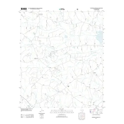
2012 Map of Patroon North
USGS Topo · Published 2012About this map
The deep creek drainages of eastern Shelby County define the landscape of this 2012 survey, where the waters of the Toledo Bend Reservoir meet the forested timberlands. Small rural settlements like New Harmony, Dreka, and Ragtown are connected by a network of farm-to-market and county roads, reflecting a community pattern deeply rooted in the East Texas piney woods. The area is marked by numerous bayous and creeks, including Martinez Bayou and Chambers Cr, which have long influenced local navigation and land use. Genealogists will find significant value in the documentation of several local burial grounds, such as Latham Cem, E Hamilton Cem, and Hollow Springs Cem. Significant landmarks like Goober Hill provide a sense of the undulating topography between the waters of the reservoir and the agricultural settlements of Jordans Store and Patroon.
Find a feature on this map
60 named features on this map. Tap any name to fly to it.
Don’t see what you’re looking for? This feature index may not catch every label — zoom into the map to look around manually.
Map Details
Editions of this 2012 Patroon North Map
This is the sole edition of this map. No revisions or reprints were ever made.
Other maps of this area

1944 · Logansport
USGS Topo · 1:62,500

1944 · Patroon
USGS Topo · 1:62,500

1953 · Alexandria
USGS Topo · 1:250,000

1953 · Palestine
USGS Topo · 1:250,000

1955 · Alexandria
USGS Topo · 1:250,000

1956 · Logansport
USGS Topo · 1:62,500

1956 · Patroon
USGS Topo · 1:62,500

1957 · Palestine
USGS Topo · 1:250,000

1958 · Center
USGS Topo · 1:62,500

1958 · San Augustine
USGS Topo · 1:62,500