
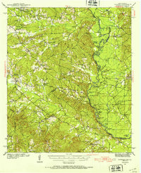
1944 Map of Patroon
USGS Topo · Published 1944About this map
The Sabine River forms the winding border between Texas and Louisiana, carving out a complex landscape of sloughs and oxbow lakes such as Saltworks Lake and Bonner Lake. Surveyed in the early 1940s, this area of Shelby County and Sabine Parish is dotted with rural infrastructure, from the Dreka Lookout to the Patroon CCC Camp. Small communities and family centers like Black Ankle, Alexanders Store, and Ragtown are visible alongside numerous local schools and houses of worship. The map reveals the intricate water network of the river bottomlands, including Tiger Lake Slough and San Patricio Bayou, which shaped the settlement patterns of East Texas during this era. Genealogists may find particular value in the locations of Hollow Springs Cem and Windham Cem, as well as several rural churches such as Oakland Ch.
Find a feature on this map
80 named features on this map. Tap any name to fly to it.
Don’t see what you’re looking for? This feature index may not catch every label — zoom into the map to look around manually.
Map Details
Editions of this 1944 Patroon Map
2 editions found
Other maps of this area

1941 · Zwolle
USGS Topo · 1:62,500

1941 · Pelican
USGS Topo · 1:62,500

1943 · Pleasant Hill
USGS Topo · 1:62,500

1944 · Negreet
USGS Topo · 1:62,500

1944 · Logansport
USGS Topo · 1:62,500

1944 · Zwolle
USGS Topo · 1:62,500

1944 · Pleasant Hill
USGS Topo · 1:62,500

1953 · Alexandria
USGS Topo · 1:250,000

1953 · Palestine
USGS Topo · 1:250,000

1954 · Negreet
USGS Topo · 1:62,500