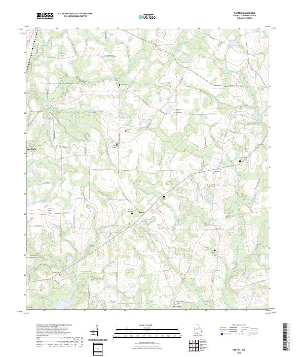
2024 Map of Patten
USGS Topo · Published 2024About this map
Merrillville and Patten anchor this portion of Thomas County, where the agricultural landscape is defined by the headwaters of the Aucilla River and its numerous tributaries. The terrain is marked by distinct hydrology, including Murphys Pond and Lancaster Pond, as well as the flow of Piscola Creek in the east. The density of small family and community burial grounds, such as Gandy Cem, Martin Cem, and Lasseter Cem, offers significant evidence of long-standing settlement patterns and local lineage. In the southwest, the Thomasville Regional Airport represents a modern infrastructure footprint amidst the rural road network, which includes traditional routes like Airline Rd and Coffee Rd. The presence of several religious landmarks, including Antioch Baptist Church and Kennedy Chapel, further highlights the established community structure of this South Georgia region.
Find a feature on this map
70 named features on this map. Tap any name to fly to it.
Don’t see what you’re looking for? This feature index may not catch every label — zoom into the map to look around manually.
Map Details
Editions of this 2024 Patten Map
This is the sole edition of this map. No revisions or reprints were ever made.
Other maps of this area

1953 · Waycross
USGS Topo · 1:250,000

1954 · Valdosta
USGS Topo · 1:250,000

1957 · Thomasville
USGS Topo · 1:62,500

1958 · Valdosta
USGS Topo · 1:250,000

1958 · Waycross
USGS Topo · 1:250,000

1959 · Valdosta
USGS Topo · 1:250,000

1961 · Quitman
USGS Topo · 1:62,500
1975 · Thomasville
USGS Topo · 1:24,000
1975 · Merrillville
USGS Topo · 1:24,000
1977 · Chastain
USGS Topo · 1:24,000