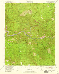
1952 Map of Patterson Mountain
USGS Topo · Published 1959About this map
Balch Camp serves as a focal point for utility and conservation work in this mid-century survey of the southern Sierra Nevada. The terrain is dominated by the confluence of the Kings River and the North Fork Kings River, where the Kings River Reservoir had begun to transform the river valley. The map documents a transitional landscape of forest management and hydroelectric infrastructure, evidenced by the Powerhouse near the river and several administrative outposts like the Black Rock Guard Sta and Rock House Guard Sta. High ridges such as Rodgers Ridge and Patterson Mountain are punctuated by fire detection points including the Fence Meadow Lookout. For the historian, the map preserves the locations of former activity at Sawmill Flat (Site) and Rancheria (Site), alongside specialized facilities like the State Fish Hatchery near Kellers Ranch.
Find a feature on this map
72 named features on this map. Tap any name to fly to it.
Don’t see what you’re looking for? This feature index may not catch every label — zoom into the map to look around manually.
Map Details
Editions of this 1952 Patterson Mountain Map
5 editions found

Other maps of this area

1903 · Tehipite
USGS Topo · 1:125,000

1904 · Kaiser
USGS Topo · 1:125,000

1905 · Tehipite
USGS Topo · 1:125,000

1912 · Mt. Goddard
USGS Topo · 1:125,000

1921 · Squaw Valley
USGS Topo · 1:31,680

1922 · Trimmer
USGS Topo · 1:96,000

1924 · Citrus Cove
USGS Topo · 1:31,680

1924 · Dinuba
USGS Topo · 1:125,000

1942 · Watts Valley
USGS Topo · 1:62,500

1942 · Dunlap
USGS Topo · 1:62,500