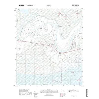
2018 Map of Patterson
USGS Topo · Published 2018About this map
The settlement of Patterson and its neighboring communities are defined by a complex labyrinth of waterways and engineering in St. Mary Parish. The landscape is a study in flood management and transit, dominated by the massive Atchafalaya Basin Floodway and the protective W Atchafalaya Basin Floodway Levee. Residents and industry are concentrated along the banks of Bayou Teche, where towns like Avalon and Calumet sit between the bayou and the northern levee systems. To the south, the terrain dissolves into the marshy expanse of the Intracoastal Waterway and the Lower Atchafalaya River, threaded by countless smaller channels like Little Bethel Bayou and Double Mouth Bayou. Infrastructure such as the Harry P Williams Memorial Airport and the BNSF Railway provides critical links across this watery geography, connecting isolated landings like Wilsons Landing to the regional economy.
Find a feature on this map
109 named features on this map. Tap any name to fly to it.
Don’t see what you’re looking for? This feature index may not catch every label — zoom into the map to look around manually.
Map Details
Editions of this 2018 Patterson Map
This is the sole edition of this map. No revisions or reprints were ever made.
Other maps of this area

1935 · Belle Isle
USGS Topo · 1:31,680

1935 · Morgan City
USGS Topo · 1:62,500

1941 · Belle Isle
USGS Topo · 1:62,500

1945 · New Orleans
USGS Topo · 1:250,000

1948 · Foster
USGS Topo · 1:62,500

1953 · Napoleonville
USGS Topo · 1:62,500

1954 · Morgan City
USGS Topo · 1:62,500

1954 · Belle Isle
USGS Topo · 1:62,500

1959 · Foster
USGS Topo · 1:62,500

1963 · New Orleans
USGS Topo · 1:250,000