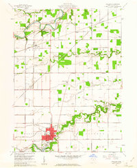
1960 Map of Paulding
USGS Topo · Published 1961About this map
The county seat of Paulding serves as the central hub of this 1960 topographic survey, showcasing a landscape defined by the intersection of rail, water, and agricultural industry. The Wabash Railroad and New York Central Railroad cut across the terrain, serving the village of Cecil and the industrial works at the Quarry and nearby Kilns. The Maumee River winds through the northern portion of the quadrangle, where several family-named burial grounds like Rochester Cem and Eaton Cem are located near the Eaton Childrens Home.
Find a feature on this map
45 named features on this map. Tap any name to fly to it.
Don’t see what you’re looking for? This feature index may not catch every label — zoom into the map to look around manually.
Map Details
Editions of this 1960 Paulding Map
3 editions found
Other maps of this area

1907 · Defiance
USGS Topo · 1:62,500

1909 · Defiance
USGS Topo · 1:62,500

1909 · Continental
USGS Topo · 1:62,500

1914 · Bryan
USGS Topo · 1:62,500

1914 · Paulding
USGS Topo · 1:62,500

1943 · Bryan
USGS Topo · 1:62,500

1944 · Paulding
USGS Topo · 1:62,500

1953 · Fort Wayne
USGS Topo · 1:250,000

1956 · Fort Wayne
USGS Topo · 1:250,000

1960 · Sherwood
USGS Topo · 1:24,000