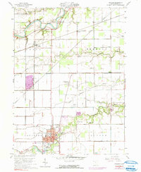
1960 Map of Paulding
USGS Topo · Published 1991About this map
Paulding serves as the focal point of this 1960 survey, displaying a structured grid featuring the Courthouse, County Hospital, and Paulding Cem along the banks of Flatrock Creek. The landscape preserves a transition from early pioneer infrastructure to mid-century industrial utility, most notably marked by the trace of the Wabash and Erie Canal (Abandoned) cutting east-west across the quadrangle. North of the county seat, the Maumee River winds past Gordon and the Eaton Childrens Home.
Find a feature on this map
49 named features on this map. Tap any name to fly to it.
Don’t see what you’re looking for? This feature index may not catch every label — zoom into the map to look around manually.
Map Details
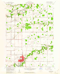
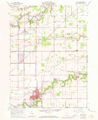
Editions of this 1960 Paulding Map
3 editions found
Other maps of this area

1907 · Defiance
USGS Topo · 1:62,500

1909 · Defiance
USGS Topo · 1:62,500

1909 · Continental
USGS Topo · 1:62,500

1914 · Bryan
USGS Topo · 1:62,500

1914 · Paulding
USGS Topo · 1:62,500

1943 · Bryan
USGS Topo · 1:62,500

1944 · Paulding
USGS Topo · 1:62,500

1953 · Fort Wayne
USGS Topo · 1:250,000

1956 · Fort Wayne
USGS Topo · 1:250,000

1960 · Sherwood
USGS Topo · 1:24,000