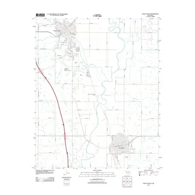
2012 Map of Pauls Valley
USGS Topo · Published 2012About this map
Pauls Valley serves as the regional anchor on this survey, situated where Rush Creek joins the winding Washita River. The map documents a landscape defined by its river bottomlands and the industrial presence of the Southeast Pauls Valley Oil Field. The town's historic footprint is clearly marked by several burial grounds, including The Old Cem, Bethlehem Cem, and Mt Olivet Cem, which reflect the early settlement patterns of Garvin County. To the south, the city of Wynnewood is shown with its organized street grid, including N Street and E Schmid St. The rural areas between these hubs are crisscrossed by a network of sectional roads and smaller tributaries like Negro Sandy Creek and Cherokee Sandy Creek, illustrating the transition from urban centers to the agricultural and petroleum-producing outskirts.
Find a feature on this map
90 named features on this map. Tap any name to fly to it.
Don’t see what you’re looking for? This feature index may not catch every label — zoom into the map to look around manually.
Map Details
Editions of this 2012 Pauls Valley Map
This is the sole edition of this map. No revisions or reprints were ever made.
Other maps of this area

1898 · Pauls Valley
USGS Topo · 1:125,000

1902 · Pauls Valley
USGS Topo · 1:125,000

1957 · Ardmore
USGS Topo · 1:250,000

1963 · Ardmore
USGS Topo · 1:250,000

1964 · Byars
USGS Topo · 1:24,000

1965 · Pauls Valley NE
USGS Topo · 1:24,000

1965 · Byars SW
USGS Topo · 1:24,000

1965 · Pauls Valley
USGS Topo · 1:24,000

1965 · Davis
USGS Topo · 1:24,000

1965 · Joy
USGS Topo · 1:24,000