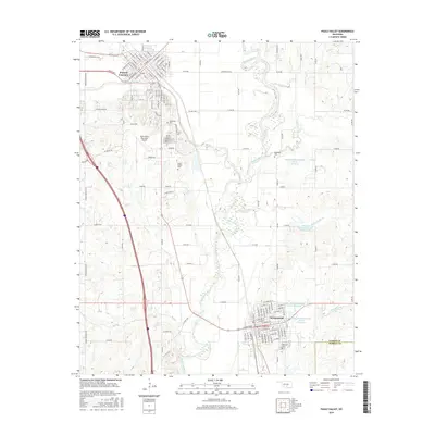
2016 Map of Pauls Valley
USGS Topo · Published 2016About this map
Pauls Valley and Wynnewood anchor this southern Oklahoma survey, situated along the winding course of the Washita River. The landscape is defined by the convergence of several major tributaries, including Rush Creek, Wolf Creek, and Cherokee Sandy Creek. A notable concentration of cemeteries, such as The Old Cemetery, Mount Olivet Cemetery, and Bethlehem Cemetery, suggests a long-standing pattern of settlement and family heritage in this region. The northern portion of the map showcases the dense street grid of the county seat, while the southern end includes the outlying town of Wynnewood. This era of land management is characterized by a series of flood control structures, including the Kickapoo Sandy Creek Site N1 and K7 Reservoirs, which illustrate the modern hydrologic engineering used to manage the area's many named creeks.
Find a feature on this map
82 named features on this map. Tap any name to fly to it.
Don’t see what you’re looking for? This feature index may not catch every label — zoom into the map to look around manually.
Map Details
Editions of this 2016 Pauls Valley Map
This is the sole edition of this map. No revisions or reprints were ever made.
Other maps of this area

1898 · Pauls Valley
USGS Topo · 1:125,000

1902 · Pauls Valley
USGS Topo · 1:125,000

1957 · Ardmore
USGS Topo · 1:250,000

1963 · Ardmore
USGS Topo · 1:250,000

1964 · Byars
USGS Topo · 1:24,000

1965 · Pauls Valley NE
USGS Topo · 1:24,000

1965 · Byars SW
USGS Topo · 1:24,000

1965 · Pauls Valley
USGS Topo · 1:24,000

1965 · Davis
USGS Topo · 1:24,000

1965 · Joy
USGS Topo · 1:24,000