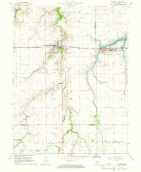
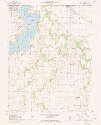
1964 Map of Pawnee
USGS Topo · Published 1966About this map
The agricultural landscape of Pawnee dominates this mid-1960s study, where the village center is defined by the Chicago and Illinois Midland railroad and local industry. Near the tracks, evidence of the area's geological utility appears in the Claypit and a Mine Dump further east near the settlement of Ellis. The map captures a quiet rural network of family-named landmarks and small communities across the Sangamon, Christian, and Montgomery county lines. Waterways like Horse Creek and its tributaries, including Henkle Branch and West Branch, carve through the townships of Ball, Cotton Hill, and Bois D'Arc. For genealogists and local historians, the inclusion of Horse Creek Cem, Calvary Cem, and the Zenobia Ch provides essential markers of the area's mid-century social fabric and settlement patterns.
Find a feature on this map
31 named features on this map. Tap any name to fly to it.
Don’t see what you’re looking for? This feature index may not catch every label — zoom into the map to look around manually.
Map Details
Editions of this 1964 Pawnee Map
4 editions found
Other maps of this area

1922 · Divernon
USGS Topo · 1:62,500

1923 · Taylorville
USGS Topo · 1:62,500

1923 · Raymond
USGS Topo · 1:62,500

1924 · Divernon
USGS Topo · 1:62,500

1925 · Taylorville
USGS Topo · 1:62,500

1925 · Raymond
USGS Topo · 1:62,500

1946 · Nokomis
USGS Topo · 1:62,500

1949 · Nokomis
USGS Topo · 1:62,500

1958 · Decatur
USGS Topo · 1:250,000
1961 · New City
USGS Topo · 1:24,000