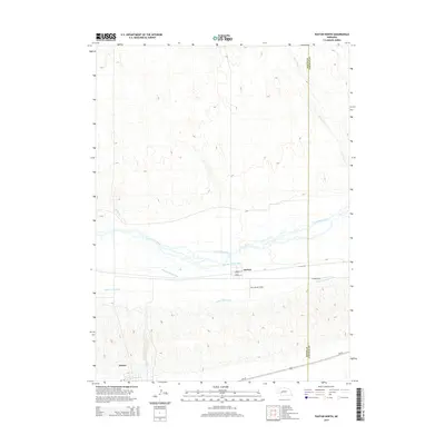
2014 Map of Paxton North
USGS Topo · Published 2014About this map
The North Platte River carves a broad valley through the center of this landscape, its braided channels flanked by a sophisticated network of irrigation and power infrastructure. Water management is the defining characteristic of this region, evidenced by the large Sheridan Wilson Canal and the Keith Lincoln Canal following the river’s course. Near the southern edge of the survey, the Sutherland Canal cuts through the bluffs, illustrating the complex engineering required to divert river water for agricultural and utility use in Western Nebraska.
Find a feature on this map
14 named features on this map. Tap any name to fly to it.
Don’t see what you’re looking for? This feature index may not catch every label — zoom into the map to look around manually.
Map Details
Editions of this 2014 Paxton North Map
This is the sole edition of this map. No revisions or reprints were ever made.
Other maps of this area

1898 · Paxton
USGS Topo · 1:125,000

1901 · Paxton
USGS Topo · 1:125,000

1954 · North Platte
USGS Topo · 1:250,000

1956 · North Platte
USGS Topo · 1:250,000

1957 · North Platte
USGS Topo · 1:250,000

1967 · North Platte
USGS Topo · 1:250,000

1971 · Sutherland Reservoir West
USGS Topo · 1:24,000
1971 · Paxton South
USGS Topo · 1:24,000
1971 · Nevens
USGS Topo · 1:24,000
1971 · Paxton North
USGS Topo · 1:24,000