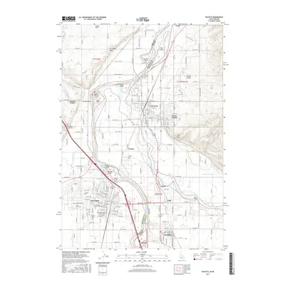
2017 Map of Payette
USGS Topo · Published 2017About this map
The Snake River serves as the dividing line between Oregon and Idaho in this 2017 survey, where the cities of Ontario and Payette face one another across the state border. This landscape is defined by an intricate network of irrigation and drainage infrastructure, including the Owyhee Canal, Washoe Ditch, and Brosman Ditch, which support the agricultural valley. The river itself is dotted with large landforms such as Duncan Island, Pool Island, and Welch Island. On the Oregon side, Ontario is home to the Treasure Valley Community College and several historic burial grounds like Evergreen Cem and Saint Johns Cem. Across the water in Idaho, the city of Payette sits just north of the Payette River confluence, near the Payette Municipal Airport and the smaller settlements of Fruitland and Ingard.
Find a feature on this map
213 named features on this map. Tap any name to fly to it.
Don’t see what you’re looking for? This feature index may not catch every label — zoom into the map to look around manually.
Map Details
Editions of this 2017 Payette Map
This is the sole edition of this map. No revisions or reprints were ever made.
Other maps of this area

1897 · Weiser
USGS Topo · 1:125,000

1898 · Nampa
USGS Topo · 1:125,000

1906 · Mitchell Butte
USGS Topo · 1:125,000

1951 · Moores Hollow
USGS Topo · 1:24,000

1951 · Malheur Butte
USGS Topo · 1:24,000

1951 · Moores Hollow
USGS Topo · 1:62,500

1951 · Payette
USGS Topo · 1:24,000

1951 · Weiser South
USGS Topo · 1:24,000

1952 · Weiser Cove
USGS Topo · 1:24,000

1952 · Birding Island
USGS Topo · 1:24,000