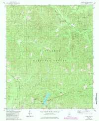
1980 Map of Payne Lake
USGS Topo · Published 1985About this map
Talladega National Forest encompasses the majority of this landscape in eastern Hale County, where the terrain is defined by the winding drainages of South Sandy Creek and Mayfield Creek. The southern portion of the sheet is centered on the recreational hub of Payne Lake, featuring several developed areas including the Payne Lake Westside Campground, Payne Lake Eastside Campground, and Spillway Campground. High ground is marked by the Payne Lookout Tower, providing a vantage point over the timbered ridges.
Find a feature on this map
20 named features on this map. Tap any name to fly to it.
Don’t see what you’re looking for? This feature index may not catch every label — zoom into the map to look around manually.
Map Details
Editions of this 1980 Payne Lake Map
2 editions found

Other maps of this area

1899 · Brookwood
USGS Topo · 1:125,000

1924 · Tuscaloosa
USGS Topo · 1:62,500

1926 · Tuscaloosa
USGS Topo · 1:62,500

1931 · Cottondale
USGS Topo · 1:48,000

1934 · Cottondale
USGS Topo · 1:62,500

1953 · Montgomery
USGS Topo · 1:250,000

1953 · Birmingham
USGS Topo · 1:250,000

1956 · Birmingham
USGS Topo · 1:250,000

1956 · Montgomery
USGS Topo · 1:250,000

1957 · Birmingham
USGS Topo · 1:250,000