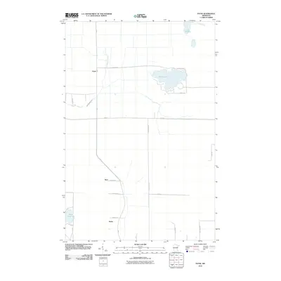
2010 Map of Payne
USGS Topo · Published 2010About this map
Payne and the surrounding rural landscape of Saint Louis County are defined by a grid of local roads and quiet water bodies as they appeared in the early 21st century. The settlement of Payne sits at a crossroads where HWY-7 intersects with Lake Nichols Rd, serving as a central point for the small nearby communities of Birch and Baden. The terrain is characterized by its drainage into the Little Whiteface River and Jenkins Creek, with prominent basins at Nichols Lake and Lake Williams. A series of family-named and descriptive routes, such as Chalberg Rd, Tremblay Rd, and Stoney Brook Rd, indicate the pattern of local land ownership and the transition from managed forest or agricultural plots to the edges of Maple Leaf Lake.
Find a feature on this map
22 named features on this map. Tap any name to fly to it.
Don’t see what you’re looking for? This feature index may not catch every label — zoom into the map to look around manually.
Map Details
Editions of this 2010 Payne Map
This is the sole edition of this map. No revisions or reprints were ever made.
Other maps of this area

1953 · Canyon
USGS Topo · 1:24,000

1953 · Payne
USGS Topo · 1:24,000

1953 · Alborn
USGS Topo · 1:24,000

1953 · Independence
USGS Topo · 1:24,000

1953 · Brookston NW
USGS Topo · 1:24,000

1953 · Duluth
USGS Topo · 1:250,000

1954 · Hibbing
USGS Topo · 1:250,000

1956 · Cotton
USGS Topo · 1:24,000

1957 · Hibbing
USGS Topo · 1:250,000

1958 · Hibbing
USGS Topo · 1:250,000