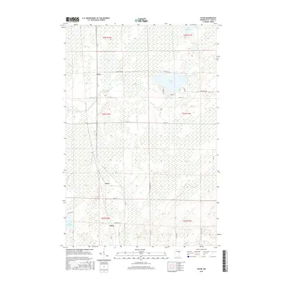
2016 Map of Payne
USGS Topo · Published 2016About this map
Nichols Lake and the Little Whiteface River define this section of Saint Louis County, where the landscape is a patchwork of wetlands and small rural settlements. The map documents the localized centers of Payne, Birch, and Baden, which are connected by a network of county and township roads. These small communities are situated within the Township and Range system, specifically across T54N and T52N. The presence of Lake Nichols Rd and Stoney Brook Rd indicates the primary corridors of movement through these wooded and marshy lands. To the north, Lake Williams sits near the boundary, while Maple Leaf Lake marks the southwestern corner, reflecting the water-rich geography typical of northern Minnesota. This survey provides a clear view of the rural infrastructure and land use patterns in the early 21st century.
Find a feature on this map
31 named features on this map. Tap any name to fly to it.
Don’t see what you’re looking for? This feature index may not catch every label — zoom into the map to look around manually.
Map Details
Editions of this 2016 Payne Map
This is the sole edition of this map. No revisions or reprints were ever made.
Other maps of this area

1953 · Canyon
USGS Topo · 1:24,000

1953 · Payne
USGS Topo · 1:24,000

1953 · Alborn
USGS Topo · 1:24,000

1953 · Independence
USGS Topo · 1:24,000

1953 · Brookston NW
USGS Topo · 1:24,000

1953 · Duluth
USGS Topo · 1:250,000

1954 · Hibbing
USGS Topo · 1:250,000

1956 · Cotton
USGS Topo · 1:24,000

1957 · Hibbing
USGS Topo · 1:250,000

1958 · Hibbing
USGS Topo · 1:250,000