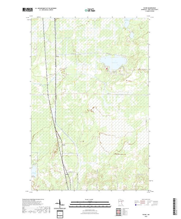
2022 Map of Payne
USGS Topo · Published 2022About this map
Payne and the surrounding wetland landscape of St. Louis County are defined by a network of rural roads and water bodies in this recent topographic survey. The area transitions from the small settlement at Payne in the north through the scattered communities of Birch and Baden further south. The Little Whiteface River meanders through the central terrain, while Nichols Lake and Lake Williams serve as significant local landmarks. The road network, including Co Rd 7 and Co Hwy 133, connects these rural outposts, reflecting the enduring settlement patterns of northern Minnesota. This map detail reveals how the local landscape is segmented by township and range lines like t53n r18w, illustrating the geometric organization of the region's vast natural spaces.
Find a feature on this map
31 named features on this map. Tap any name to fly to it.
Don’t see what you’re looking for? This feature index may not catch every label — zoom into the map to look around manually.
Map Details
Editions of this 2022 Payne Map
This is the sole edition of this map. No revisions or reprints were ever made.
Other maps of this area

1953 · Canyon
USGS Topo · 1:24,000

1953 · Payne
USGS Topo · 1:24,000

1953 · Alborn
USGS Topo · 1:24,000

1953 · Independence
USGS Topo · 1:24,000

1953 · Brookston NW
USGS Topo · 1:24,000

1953 · Duluth
USGS Topo · 1:250,000

1954 · Hibbing
USGS Topo · 1:250,000

1956 · Cotton
USGS Topo · 1:24,000

1957 · Hibbing
USGS Topo · 1:250,000

1958 · Hibbing
USGS Topo · 1:250,000