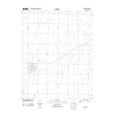
2012 Map of Peabody
USGS Topo · Published 2012About this map
Peabody serves as the focal point of this Marion County survey, where a rigid grid of rural section roads like Old Mill Rd and Quail Creek Rd meets the winding path of Doyle Cr. The landscape reflects a mix of traditional agricultural layout and energy production, notably at the Unger Oil Field north of town. Local community landmarks include the Peabody Golf Course and Prairie Lawn Cem, which lies just north of the residential blocks. The town's internal geography is detailed down to specific street names like N Walnut St and S Maple St, providing a clear record of the settlement's footprint in the early 21st century. Spring Cr feeds into the larger drainage system, illustrating the hydrology that dictates the placement of the surrounding Kansas homesteads.
Find a feature on this map
37 named features on this map. Tap any name to fly to it.
Don’t see what you’re looking for? This feature index may not catch every label — zoom into the map to look around manually.
Map Details
Editions of this 2012 Peabody Map
This is the sole edition of this map. No revisions or reprints were ever made.
Other maps of this area

1889 · Newton
USGS Topo · 1:125,000

1894 · Newton
USGS Topo · 1:125,000

1898 · Cottonwood Falls
USGS Topo · 1:125,000

1955 · Hutchinson
USGS Topo · 1:250,000

1957 · Peabody NW
USGS Topo · 1:24,000

1957 · Florence
USGS Topo · 1:24,000

1957 · Lincolnville SW
USGS Topo · 1:24,000

1957 · Peabody
USGS Topo · 1:24,000

1957 · Elbing
USGS Topo · 1:24,000

1959 · Hutchinson
USGS Topo · 1:250,000