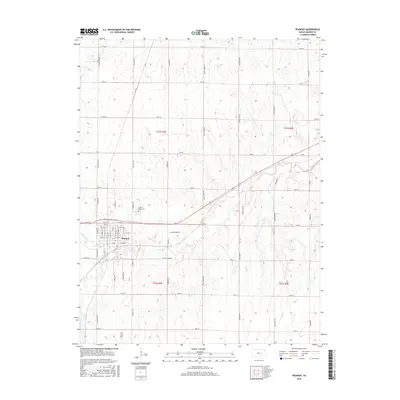
2015 Map of Peabody
USGS Topo · Published 2015About this map
Peabody serves as the primary hub of this south-central Kansas landscape, organized around a dense grid of residential streets including Walnut St and Nighthawk Rd. The town sits at the intersection of a significant rail line and local thoroughfares, illustrating the transition from 19th-century railroad dependence to modern automotive infrastructure. Surrounding the town, the terrain is defined by the winding paths of Doyle Cr and Spring Cr, which cut through the agricultural sections. To the north of the main settlement lies Prairie Lawn Cem, a significant site for local genealogical research located along Cemetery Rd. The section lines are clearly marked by an extensive rural road network, including Old Mill Rd and Quail Creek Rd, reflecting the enduring township and range system that continues to dictate the region's land use and agricultural development.
Find a feature on this map
46 named features on this map. Tap any name to fly to it.
Don’t see what you’re looking for? This feature index may not catch every label — zoom into the map to look around manually.
Map Details
Editions of this 2015 Peabody Map
This is the sole edition of this map. No revisions or reprints were ever made.
Other maps of this area

1889 · Newton
USGS Topo · 1:125,000

1894 · Newton
USGS Topo · 1:125,000

1898 · Cottonwood Falls
USGS Topo · 1:125,000

1955 · Hutchinson
USGS Topo · 1:250,000

1957 · Peabody NW
USGS Topo · 1:24,000

1957 · Florence
USGS Topo · 1:24,000

1957 · Lincolnville SW
USGS Topo · 1:24,000

1957 · Peabody
USGS Topo · 1:24,000

1957 · Elbing
USGS Topo · 1:24,000

1959 · Hutchinson
USGS Topo · 1:250,000