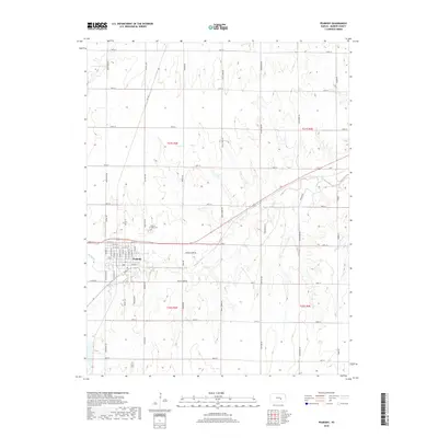
2018 Map of Peabody
USGS Topo · Published 2018About this map
Peabody serves as the central hub of this Marion County quadrangle, situated at the confluence of the local grid and the meandering path of Doyle Cr. The town's residential and commercial core is meticulously detailed, showing the layout of streets like N Peabody St, N Walnut St, and N Locust St north of the primary east-west corridors. Just outside the main settlement, the Prairie Lawn Cem stands near Cemetery Rd, providing a key landmark for genealogical research. The surrounding landscape is defined by the agricultural drainage of Spring Cr and the broader township boundaries of t21s r3e and t22s r3e. This survey captures the rural character of the Kansas prairie, where section roads like Old Mill Rd and Sunflower Rd partition the terrain into a sprawling patchwork of homesteads and fields.
Find a feature on this map
52 named features on this map. Tap any name to fly to it.
Don’t see what you’re looking for? This feature index may not catch every label — zoom into the map to look around manually.
Map Details
Editions of this 2018 Peabody Map
This is the sole edition of this map. No revisions or reprints were ever made.
Other maps of this area

1889 · Newton
USGS Topo · 1:125,000

1894 · Newton
USGS Topo · 1:125,000

1898 · Cottonwood Falls
USGS Topo · 1:125,000

1955 · Hutchinson
USGS Topo · 1:250,000

1957 · Peabody NW
USGS Topo · 1:24,000

1957 · Florence
USGS Topo · 1:24,000

1957 · Lincolnville SW
USGS Topo · 1:24,000

1957 · Peabody
USGS Topo · 1:24,000

1957 · Elbing
USGS Topo · 1:24,000

1959 · Hutchinson
USGS Topo · 1:250,000