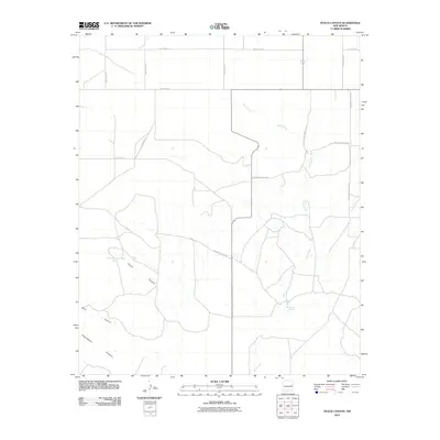
2010 Map of Peach Canyon
USGS Topo · Published 2010About this map
Peach Canyon Spring and Bull Tank Spring provide critical water points in this arid stretch of eastern New Mexico. The landscape is defined by the significant drainage of Peach Canyon, which runs alongside Sand Canyon and Cottonwood Canyon as they carve through the High Plains. This 2010 USGS survey illustrates the rigid section-line road grid typical of the region's ranching and agricultural layout, featuring routes like Quay Road 25 and N Roosevelt Road 22. The map details how modern infrastructure, such as County Rd 3-7 and C 053, follows the natural contours of the land while maintaining the geometric precision of local land divisions. The presence of Sand Creek suggests intermittent water flow in an area where topographical changes are subtle but vital for livestock and settlement.
Find a feature on this map
19 named features on this map. Tap any name to fly to it.
Don’t see what you’re looking for? This feature index may not catch every label — zoom into the map to look around manually.
Map Details
Editions of this 2010 Peach Canyon Map
This is the sole edition of this map. No revisions or reprints were ever made.
Other maps of this area

1954 · Fort Sumner
USGS Topo · 1:250,000

1954 · Clovis
USGS Topo · 1:250,000

1958 · Fort Sumner
USGS Topo · 1:250,000

1958 · Clovis
USGS Topo · 1:250,000

1968 · Hassell
USGS Topo · 1:24,000

1968 · Candy Mesa
USGS Topo · 1:24,000

1968 · Taiban
USGS Topo · 1:24,000

1973 · Tolar
USGS Topo · 1:24,000

1973 · Krider
USGS Topo · 1:24,000

1973 · House
USGS Topo · 1:24,000