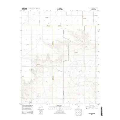
2013 Map of Peach Canyon
USGS Topo · Published 2013About this map
Peach Canyon and its associated Peach Canyon Spring define the rugged break in the High Plains of eastern New Mexico, where the landscape drops away from the plateau toward the drainage systems of Sand Cr. This 2013 survey illustrates a sparsely populated ranching region at the intersection of Roosevelt, De Baca, and Quay Counties. The map reveals how water sources like Bull Tank Spring dictate the local geography, providing vital anchors in an arid environment. A grid of section lines and named rural routes, such as Candy Mesa Rd and N Roosevelt Road 20, connect isolated points across the terrain. The presence of Sand Canyon and Cottonwood Canyon further emphasizes the deep erosion patterns characteristic of this Llano Estacado margin.
Find a feature on this map
31 named features on this map. Tap any name to fly to it.
Don’t see what you’re looking for? This feature index may not catch every label — zoom into the map to look around manually.
Map Details
Editions of this 2013 Peach Canyon Map
This is the sole edition of this map. No revisions or reprints were ever made.
Other maps of this area

1954 · Fort Sumner
USGS Topo · 1:250,000

1954 · Clovis
USGS Topo · 1:250,000

1958 · Fort Sumner
USGS Topo · 1:250,000

1958 · Clovis
USGS Topo · 1:250,000

1968 · Hassell
USGS Topo · 1:24,000

1968 · Candy Mesa
USGS Topo · 1:24,000

1968 · Taiban
USGS Topo · 1:24,000

1973 · Tolar
USGS Topo · 1:24,000

1973 · Krider
USGS Topo · 1:24,000

1973 · House
USGS Topo · 1:24,000