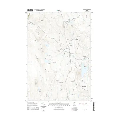
2015 Map of Peacham
USGS Topo · Published 2015About this map
The hilltop village of Peacham and its surrounding hamlets illustrate the enduring agricultural and residential patterns of Caledonia County. Settled along the winding Bayley Hazen Rd and Macks Mountain Rd, the landscape is defined by its numerous small burial grounds, such as Peacham East Cem and the Reverend Worcester Cem, which reflect the area's early genealogy. The terrain transitions from the heights of Lookout Mtn and Devils Hill down to significant water bodies like Harvey Lake and Ewell Pond.
Find a feature on this map
103 named features on this map. Tap any name to fly to it.
Don’t see what you’re looking for? This feature index may not catch every label — zoom into the map to look around manually.
Map Details
Editions of this 2015 Peacham Map
This is the sole edition of this map. No revisions or reprints were ever made.
Other maps of this area

1931 · Woodsville
USGS Topo · 1:48,000

1935 · Woodsville
USGS Topo · 1:62,500

1938 · St. Johnsbury
USGS Topo · 1:48,000

1939 · Plainfield
USGS Topo · 1:48,000

1940 · Plainfield
USGS Topo · 1:62,500

1941 · Woodsville
USGS Topo · 1:62,500

1943 · Plainfield
USGS Topo · 1:62,500

1943 · St. Johnsbury
USGS Topo · 1:62,500

1947 · Corinth
USGS Topo · 1:62,500

1948 · East Barre
USGS Topo · 1:62,500