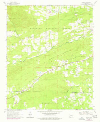
1966 Map of Pearcy
USGS Topo · Published 1977About this map
Mazarn Valley and the northern slopes of Pearcy Mountain define the topography of this mid-1960s survey, updated with 1970s aerial data. The map documents a landscape of scattered rural communities and timberland, centered around the village of Pearcy and the crossing of Mazarn Creek. To the north, the Ouachita National Forest boundary borders the settlement at Maddox, while the southern reaches cross into Hot Spring County near Oma. Evidence of former transportation and industry appears along the Old Railroad Grade and a Gravel Pit near Chandler. Local genealogists will find several family-named landmarks and historical community centers, including McDowell Cem, Cross Roads Cem, and Meyers Creek Ch, which served as both a spiritual and educational hub for the western Meyers area.
Find a feature on this map
24 named features on this map. Tap any name to fly to it.
Don’t see what you’re looking for? This feature index may not catch every label — zoom into the map to look around manually.
Map Details
Editions of this 1966 Pearcy Map
2 editions found
Other maps of this area

1890 · Hot Springs
USGS Topo · 1:125,000

1894 · Hot Springs
USGS Topo · 1:125,000

1955 · Little Rock
USGS Topo · 1:250,000

1956 · Little Rock
USGS Topo · 1:250,000

1960 · Little Rock
USGS Topo · 1:250,000

1962 · Crystal Springs
USGS Topo · 1:24,000

1962 · Mc Graw Mountain
USGS Topo · 1:24,000

1964 · Little Rock
USGS Topo · 1:250,000

1966 · Pearcy
USGS Topo · 1:24,000

1966 · Hempwallace
USGS Topo · 1:24,000