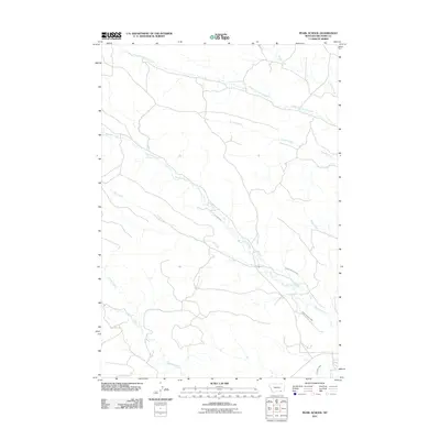
2011 Map of Pearl School
USGS Topo · Published 2011About this map
Squirrel Creek and its many tributaries define this section of Big Horn County, Montana, where a complex network of man-made irrigation infrastructure is layered over the natural drainage system. Early 21st-century water management is evident through several named canals, including Cormack Ditch, Powers Cormack Ditch, and the Powers Brothers Ditch, which divert water to sustain the local agricultural landscape. The terrain is marked by seasonal and permanent waterways like South Fork Spring Creek, Pearson Creek, and Youngs Creek, which carve out the subtle relief of the region. This 2011 survey captures the rural character of the area, where the spatial relationship between water sources and land use remains central to the community's layout. The map also records smaller features like Pond Creek and Gladwater Ditch, providing a detailed look at the local hydrography that has shaped the ranching and farming history of this Montana township.
Find a feature on this map
12 named features on this map. Tap any name to fly to it.
Don’t see what you’re looking for? This feature index may not catch every label — zoom into the map to look around manually.
Map Details
Editions of this 2011 Pearl School Map
This is the sole edition of this map. No revisions or reprints were ever made.
Other maps of this area

1894 · Rosebud
USGS Topo · 1:125,000

1895 · Dayton
USGS Topo · 1:125,000

1901 · Rosebud
USGS Topo · 1:125,000

1901 · Dayton
USGS Topo · 1:125,000

1909 · Sheridan
USGS Topo · 1:125,000

1911 · Sheridan
USGS Topo · 1:125,000

1954 · Hardin
USGS Topo · 1:250,000

1955 · Sheridan
USGS Topo · 1:250,000

1957 · Hardin
USGS Topo · 1:250,000

1958 · Hardin
USGS Topo · 1:250,000