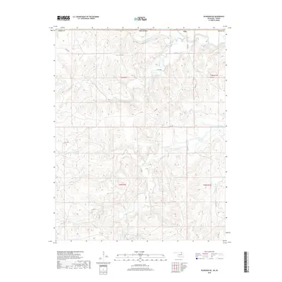
2018 Map of Pearsonia NE
USGS Topo · Published 2018About this map
Elgin sits at the northern edge of this survey, positioned where the Caney River winds through the drainage basins of the southern Kansas and northern Oklahoma borderlands. The landscape is defined by an intricate network of waterways, including Pond Creek and its tributary S Fork Pond Cr, which carve through the terrain south of the state line. This 2018 U.S. Geological Survey representation details the section lines and township boundaries of t29n r9e, t29n r10e, t28n r9e, and t28n r10e, marking the transition from Chautauqua County into Osage Co. A series of county roads, such as Co RD 4930 and Co RD 4851, provide the primary infrastructure through these prairie uplands. The distribution of small creeks like Dry Cr and N Fox Cr illustrates the complex natural irrigation patterns essential to the ranching and agricultural history of this border region.
Find a feature on this map
23 named features on this map. Tap any name to fly to it.
Don’t see what you’re looking for? This feature index may not catch every label — zoom into the map to look around manually.
Map Details
Editions of this 2018 Pearsonia NE Map
This is the sole edition of this map. No revisions or reprints were ever made.
Other maps of this area

1885 · Sedan
USGS Topo · 1:125,000

1889 · Sedan
USGS Topo · 1:125,000

1909 · Pawhuska
USGS Topo · 1:125,000

1910 · Pawhuska
USGS Topo · 1:125,000

1955 · Wichita
USGS Topo · 1:250,000

1955 · Enid
USGS Topo · 1:250,000

1958 · Enid
USGS Topo · 1:250,000

1958 · Wichita
USGS Topo · 1:250,000

1960 · Nanos
USGS Topo · 1:24,000

1960 · Herd
USGS Topo · 1:24,000