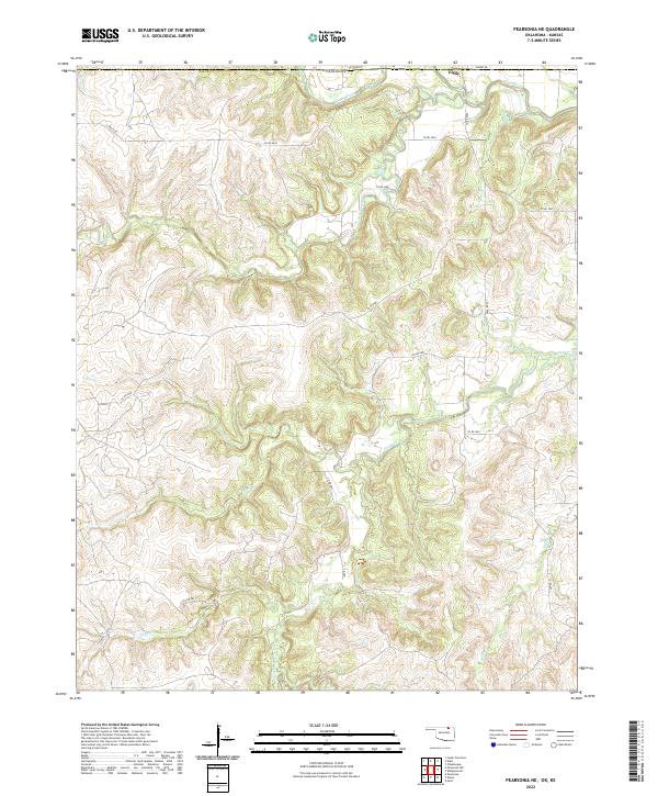
2022 Map of Pearsonia NE
USGS Topo · Published 2022About this map
Caney River meanders across the northern reaches of this rural Osage County landscape, where the terrain is defined by a dense network of creek drainages and high ridges. The settlement of Elgin sits near the state line, serving as a focal point for a region characterized by winding rural roads like Arrow Rd and Co Rd 4930. The map reveals the intricate hydrologic pattern of the area, with Pond Creek, Buck Creek, and N Fox Cr carving deep valleys through the limestone hills of the Cross Timbers. This topography reflects the traditional ranching and oil-production landscape of northern Oklahoma, where the land remains largely undivided by major development, preserving the historical survey patterns of the Osage Reservation.
Find a feature on this map
25 named features on this map. Tap any name to fly to it.
Don’t see what you’re looking for? This feature index may not catch every label — zoom into the map to look around manually.
Map Details
Editions of this 2022 Pearsonia NE Map
This is the sole edition of this map. No revisions or reprints were ever made.
Other maps of this area

1885 · Sedan
USGS Topo · 1:125,000

1889 · Sedan
USGS Topo · 1:125,000

1909 · Pawhuska
USGS Topo · 1:125,000

1910 · Pawhuska
USGS Topo · 1:125,000

1955 · Wichita
USGS Topo · 1:250,000

1955 · Enid
USGS Topo · 1:250,000

1958 · Enid
USGS Topo · 1:250,000

1958 · Wichita
USGS Topo · 1:250,000

1960 · Nanos
USGS Topo · 1:24,000

1960 · Herd
USGS Topo · 1:24,000