2021 Map of Pearsonville
USGS Topo · Published 2021About this map
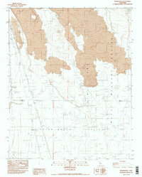
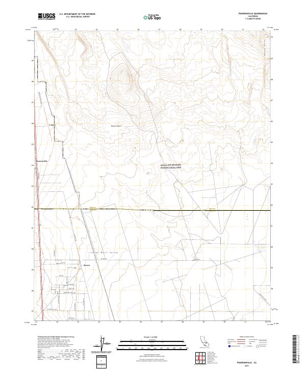
Pearsonville stands as a primary landmark in this desert landscape where the Mojave Desert meets the Indian Wells Valley. The map illustrates a transition from the elevated White Hills in the northeast to the residential and service corridors along the western boundary. Small settlements such as Linnie and Brown are connected by an intricate grid of roads, including Nine Mile Canyon Rd and Sand Canyon Rd. This survey details the intersection of regional geography and local infrastructure, notably marking the Inyo Co Kern Co boundary. The southern portion of the quadrangle shows a concentrated network of local streets like Coyote Trail Ave and Panorama Trail Ave, reflecting the modern development patterns of the valley floor.
Find a feature on this map
29 named features on this map. Tap any name to fly to it.
Don’t see what you’re looking for? This feature index may not catch every label — zoom into the map to look around manually.
Map Details
Editions of this 2021 Pearsonville Map
This is the sole edition of this map. No revisions or reprints were ever made.