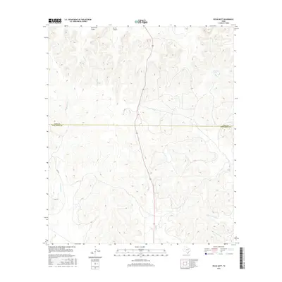
2016 Map of Pecan Mott
USGS Topo · Published 2016About this map
Buffalo Spring and Houston Springs mark the arid landscape of the West Texas divide, where the boundary between Coke Co and Tom Green Co follows the high ground. This 2016 survey illustrates the complex drainage patterns of the region, featuring deep incisions like Butterfield Canyon and Spring Canyon that feed into the larger creek systems. Water sources are the defining landmarks here, from the headwaters of Bald Eagle Cr in the west to Mule Creek Spring in the east. The map records the sparse network of rural routes, including Sutton Rd and Mount Rd, which navigate the terrain between seasonal watercourses such as Crows Nest Cr and Valentine Br. The topography reveals a land defined by its hydrology, where named springs provided essential anchor points for ranching and travel.
Find a feature on this map
16 named features on this map. Tap any name to fly to it.
Don’t see what you’re looking for? This feature index may not catch every label — zoom into the map to look around manually.
Map Details
Editions of this 2016 Pecan Mott Map
This is the sole edition of this map. No revisions or reprints were ever made.
Other maps of this area

1891 · Hayrick
USGS Topo · 1:125,000

1894 · Hayrick
USGS Topo · 1:125,000

1921 · Mays School
USGS Topo · 1:31,680

1954 · San Angelo
USGS Topo · 1:250,000

1957 · Carlsbad
USGS Topo · 1:62,500

1957 · Harriet
USGS Topo · 1:62,500

1957 · Mount Nebo
USGS Topo · 1:24,000
1957 · San Angelo North
USGS Topo · 1:24,000

1958 · San Angelo
USGS Topo · 1:250,000
1961 · Shawville
USGS Topo · 1:24,000