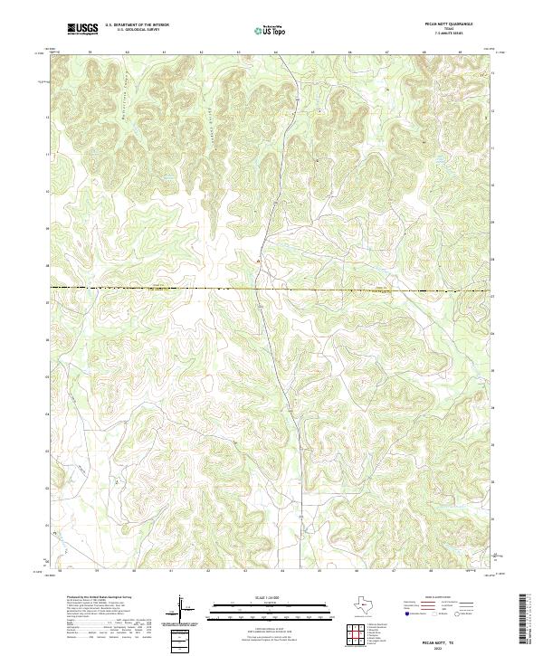
2022 Map of Pecan Mott
USGS Topo · Published 2022About this map
Buffalo Spring and Houston Springs anchor this portion of the Edwards Plateau along the county line between Coke and Tom Green. The landscape is defined by deep incisions like Butterfield Canyon and Spring Canyon, which channel intermittent drainage toward larger systems such as Liveoak Creek and Buffalo Creek. These water sources were historically vital for ranching operations in this arid region of West Texas, where groundwater access dictated the location of early land claims and livestock routes.
Find a feature on this map
16 named features on this map. Tap any name to fly to it.
Don’t see what you’re looking for? This feature index may not catch every label — zoom into the map to look around manually.
Map Details
Editions of this 2022 Pecan Mott Map
This is the sole edition of this map. No revisions or reprints were ever made.
Other maps of this area

1891 · Hayrick
USGS Topo · 1:125,000

1894 · Hayrick
USGS Topo · 1:125,000

1921 · Mays School
USGS Topo · 1:31,680

1954 · San Angelo
USGS Topo · 1:250,000

1957 · Carlsbad
USGS Topo · 1:62,500

1957 · Harriet
USGS Topo · 1:62,500

1957 · Mount Nebo
USGS Topo · 1:24,000
1957 · San Angelo North
USGS Topo · 1:24,000

1958 · San Angelo
USGS Topo · 1:250,000
1961 · Shawville
USGS Topo · 1:24,000