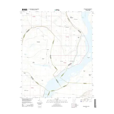
2014 Map of Pecan Point
USGS Topo · Published 2014About this map
Pecan Point and the surrounding river bottoms define this complex hydrologic landscape where the Mississippi River creates a shifting border between Arkansas and Tennessee. The map reveals the intricate secondary waterways and landforms shaped by the river's movement, including the Centennial Cutoff and the aptly named Devils Race Course. Small settlements like Corona, Black Cat, and Shawnee are scattered across the alluvial plain, connected by a network of rural routes such as Corona Rd and W Ar-118.
Find a feature on this map
61 named features on this map. Tap any name to fly to it.
Don’t see what you’re looking for? This feature index may not catch every label — zoom into the map to look around manually.
Map Details
Editions of this 2014 Pecan Point Map
This is the sole edition of this map. No revisions or reprints were ever made.
Other maps of this area

1931 · Jericho
USGS Topo · 1:62,500

1939 · Jericho
USGS Topo · 1:62,500

1939 · Evadale
USGS Topo · 1:62,500

1942 · Millington
USGS Topo · 1:62,500

1952 · Jericho
USGS Topo · 1:62,500

1953 · Memphis
USGS Topo · 1:250,000

1956 · Evadale
USGS Topo · 1:62,500

1956 · Memphis
USGS Topo · 1:250,000

1956 · Blytheville
USGS Topo · 1:250,000

1959 · Blytheville
USGS Topo · 1:250,000