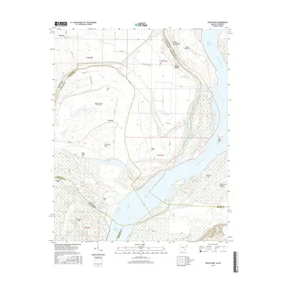
2017 Map of Pecan Point
USGS Topo · Published 2017About this map
Pecan Point sits atop a sharp bend in the Mississippi River, where the state boundary between Arkansas and Tennessee follows the shifting path of the river's historic channel. This complex riparian landscape is defined by former chutes and river-cut islands, such as Island Number Thirty-seven and Dean Island, which illustrate the volatile nature of the river before modern engineering stabilized its banks. Small settlements like Corona and Shawnee are connected by rural routes such as Old River Slough Rd and Corona Rd, serving an area dominated by agricultural fields and flood-prone bottomlands.
Find a feature on this map
53 named features on this map. Tap any name to fly to it.
Don’t see what you’re looking for? This feature index may not catch every label — zoom into the map to look around manually.
Map Details
Editions of this 2017 Pecan Point Map
This is the sole edition of this map. No revisions or reprints were ever made.
Other maps of this area

1931 · Jericho
USGS Topo · 1:62,500

1939 · Jericho
USGS Topo · 1:62,500

1939 · Evadale
USGS Topo · 1:62,500

1942 · Millington
USGS Topo · 1:62,500

1952 · Jericho
USGS Topo · 1:62,500

1953 · Memphis
USGS Topo · 1:250,000

1956 · Evadale
USGS Topo · 1:62,500

1956 · Memphis
USGS Topo · 1:250,000

1956 · Blytheville
USGS Topo · 1:250,000

1959 · Blytheville
USGS Topo · 1:250,000