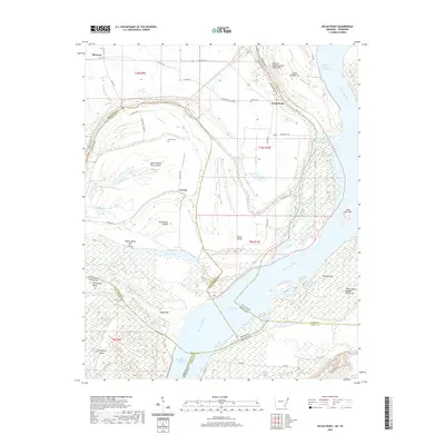
2020 Map of Pecan Point
USGS Topo · Published 2020About this map
Mississippi River shifts and state boundaries define this complex riverine landscape where Arkansas and Tennessee meet along a series of historic chutes and islands. The settlement of Pecan Point sits near the Bend of Island Number Thirty-five, anchored by local landmarks like Jacob Cem. The area is characterized by large fluvial features such as Centennial Island and Dean Island, which are surrounded by smaller water bodies like Pumpkin Lake and Corona Lake. This map captures the intricate jurisdictional lines that weave through the waterway, where the Mississippi County and Tipton County border reflects the river's older path. Genealogists can identify family sites at Barrow Cem or trace the geography of the Devils Race Course, while researchers of river history can locate sandbars and former channels like Old Brandywine Chute and Centennial Cutoff.
Find a feature on this map
46 named features on this map. Tap any name to fly to it.
Don’t see what you’re looking for? This feature index may not catch every label — zoom into the map to look around manually.
Map Details
Editions of this 2020 Pecan Point Map
This is the sole edition of this map. No revisions or reprints were ever made.
Other maps of this area

1931 · Jericho
USGS Topo · 1:62,500

1939 · Jericho
USGS Topo · 1:62,500

1939 · Evadale
USGS Topo · 1:62,500

1942 · Millington
USGS Topo · 1:62,500

1952 · Jericho
USGS Topo · 1:62,500

1953 · Memphis
USGS Topo · 1:250,000

1956 · Evadale
USGS Topo · 1:62,500

1956 · Memphis
USGS Topo · 1:250,000

1956 · Blytheville
USGS Topo · 1:250,000

1959 · Blytheville
USGS Topo · 1:250,000