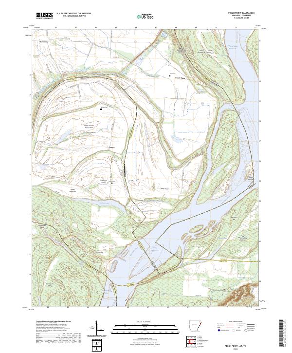
2024 Map of Pecan Point
USGS Topo · Published 2024About this map
The Mississippi River creates a complex, ever-shifting landscape of chutes, bars, and islands along the border of Arkansas and Tennessee. This survey captures a terrain defined by hydraulic forces, where Centennial Island and the Centennial Cutoff indicate a significant historical shift in the river's main channel. The settlement of Pecan Point sits near the riverbank, while the interior is marked by small communities like Shawnee. Genealogists may find value in the scattered burial grounds that remain on the higher ground of these river islands, including Jacob Cem, Barrow Cem, and Corona Cem. The presence of features such as Devils Race Course and Happy Valley Bar suggests the difficult navigation and localized landforms typical of the lower Mississippi floodplains. Extensive wetland systems surround Corona Lake and Pumpkin Lake, illustrating the reclaimed and natural bottomlands of this riverine corridor.
Find a feature on this map
54 named features on this map. Tap any name to fly to it.
Don’t see what you’re looking for? This feature index may not catch every label — zoom into the map to look around manually.
Map Details
Editions of this 2024 Pecan Point Map
This is the sole edition of this map. No revisions or reprints were ever made.
Other maps of this area

1931 · Jericho
USGS Topo · 1:62,500

1939 · Jericho
USGS Topo · 1:62,500

1939 · Evadale
USGS Topo · 1:62,500

1942 · Millington
USGS Topo · 1:62,500

1952 · Jericho
USGS Topo · 1:62,500

1953 · Memphis
USGS Topo · 1:250,000

1956 · Evadale
USGS Topo · 1:62,500

1956 · Memphis
USGS Topo · 1:250,000

1956 · Blytheville
USGS Topo · 1:250,000

1959 · Blytheville
USGS Topo · 1:250,000