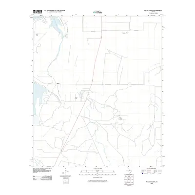
2010 Map of Pecan Station
USGS Topo · Published 2010About this map
Lake Nasworthy and the winding course of the South Concho River anchor the western edge of this Tom Green County landscape. The area is characterized by the expansive Lipan Flat, a region where aviation and energy infrastructure have left a distinct mark on the geography. Mathis Field serves as a primary aviation hub, while the smaller Reece Field and the Pecan Station Oil Field reflect the varied industrial and utility land use typical of the outskirts of San Angelo. Settlement is sparse, with the small community of Byrne located near the intersection of several rural routes. Seasonal watercourses like Pecan Creek and Ninemile Creek drain the level terrain, crisscrossed by a network of local roads such as Door Key Rd and Walling Pecan Rd that connect outlying ranching and industrial sites.
Find a feature on this map
22 named features on this map. Tap any name to fly to it.
Don’t see what you’re looking for? This feature index may not catch every label — zoom into the map to look around manually.
Map Details
Editions of this 2010 Pecan Station Map
This is the sole edition of this map. No revisions or reprints were ever made.
Other maps of this area

1892 · San Angelo
USGS Topo · 1:125,000

1895 · Sherwood
USGS Topo · 1:125,000

1924 · San Angelo 2-c
USGS Topo · 1:48,000

1924 · Sherwood 1-d
USGS Topo · 1:48,000

1924 · San Angelo 2-b
USGS Topo · 1:48,000

1924 · Sherwood 1-a
USGS Topo · 1:48,000

1928 · Wall
USGS Topo · 1:62,500

1928 · Tankersly
USGS Topo · 1:62,500

1954 · San Angelo
USGS Topo · 1:250,000

1957 · Twin Buttes
USGS Topo · 1:24,000