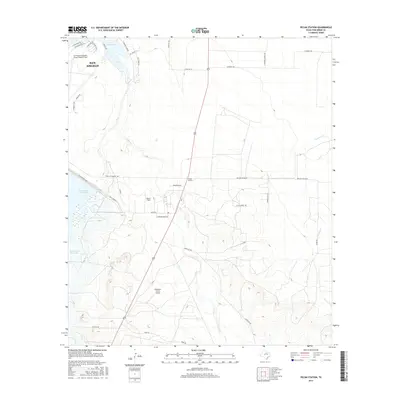
2016 Map of Pecan Station
USGS Topo · Published 2016About this map
The southern edge of San Angelo meets the ranching and aviation landscapes of Tom Green County in this 2016 survey. Water management infrastructure dominates the western terrain, where the Twin Buttes Dam holds back the waters of Twin Buttes Reservoir. To the northeast, the shoreline of Lake Nasworthy is lined by a network of residential roads like S Country Club Rd and S Concho Dr. The map illustrates a region heavily influenced by flight operations, featuring the expansive San Angelo Regional Airport/Mathis Field alongside smaller landing strips like Reece Field and Keystone Ranch Airport. Between these hubs, the landscape is defined by the winding paths of Pecan Cr and Ninemile Cr, which cross a grid of rural routes including Walling-Pecan Rd and Door Key Rd.
Find a feature on this map
39 named features on this map. Tap any name to fly to it.
Don’t see what you’re looking for? This feature index may not catch every label — zoom into the map to look around manually.
Map Details
Editions of this 2016 Pecan Station Map
This is the sole edition of this map. No revisions or reprints were ever made.
Other maps of this area

1892 · San Angelo
USGS Topo · 1:125,000

1895 · Sherwood
USGS Topo · 1:125,000

1924 · San Angelo 2-c
USGS Topo · 1:48,000

1924 · Sherwood 1-d
USGS Topo · 1:48,000

1924 · San Angelo 2-b
USGS Topo · 1:48,000

1924 · Sherwood 1-a
USGS Topo · 1:48,000

1928 · Wall
USGS Topo · 1:62,500

1928 · Tankersly
USGS Topo · 1:62,500

1954 · San Angelo
USGS Topo · 1:250,000

1957 · Twin Buttes
USGS Topo · 1:24,000