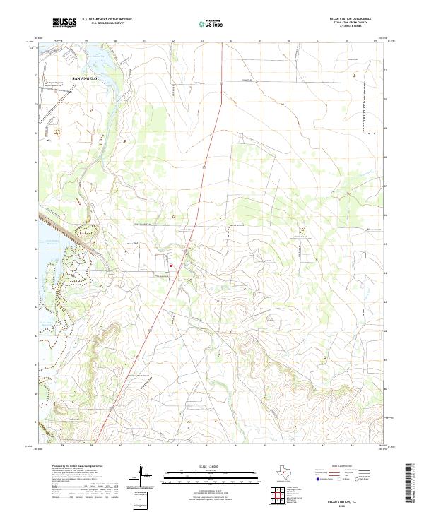
2022 Map of Pecan Station
USGS Topo · Published 2022About this map
Lake Nasworthy and the southern fringes of San Angelo dominate the northern portion of this landscape, where suburban expansion meets the open brush and ranchland of Tom Green County. The area is a vital aviation hub, featuring the extensive runways of the San Angelo Regional Airport/Mathis Field alongside smaller landing strips like Reece Field and Keystone Ranch Airport. These facilities underscore the region's importance for both regional transport and private aviation in West Texas.
Find a feature on this map
40 named features on this map. Tap any name to fly to it.
Don’t see what you’re looking for? This feature index may not catch every label — zoom into the map to look around manually.
Map Details
Editions of this 2022 Pecan Station Map
This is the sole edition of this map. No revisions or reprints were ever made.
Other maps of this area

1892 · San Angelo
USGS Topo · 1:125,000

1895 · Sherwood
USGS Topo · 1:125,000

1924 · San Angelo 2-c
USGS Topo · 1:48,000

1924 · Sherwood 1-d
USGS Topo · 1:48,000

1924 · San Angelo 2-b
USGS Topo · 1:48,000

1924 · Sherwood 1-a
USGS Topo · 1:48,000

1928 · Wall
USGS Topo · 1:62,500

1928 · Tankersly
USGS Topo · 1:62,500

1954 · San Angelo
USGS Topo · 1:250,000

1957 · Twin Buttes
USGS Topo · 1:24,000