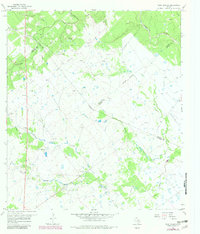
1966 Map of Peck Branch
USGS Topo · Published 1983About this map
Salem serves as a central landmark in this coastal prairie landscape, where the convergence of several Texas counties—Victoria, De Witt, Lavaca, and Jackson—creates a complex web of jurisdictional boundaries. The terrain is defined by a dense network of drainage systems, including the winding Chicolete Creek and Arenosa Creek, which suggest the seasonal flow patterns of the region.
Find a feature on this map
20 named features on this map. Tap any name to fly to it.
Don’t see what you’re looking for? This feature index may not catch every label — zoom into the map to look around manually.
Map Details
Editions of this 1966 Peck Branch Map
2 editions found
Other maps of this area

1951 · Inez NW
USGS Topo · 1:24,000

1951 · Inez
USGS Topo · 1:24,000

1953 · Beeville
USGS Topo · 1:250,000

1953 · Seguin
USGS Topo · 1:250,000

1956 · Beeville
USGS Topo · 1:250,000

1958 · Seguin
USGS Topo · 1:250,000

1960 · Beeville
USGS Topo · 1:250,000

1962 · Terryville
USGS Topo · 1:24,000

1963 · Fordtran
USGS Topo · 1:24,000

1963 · Nursery
USGS Topo · 1:24,000