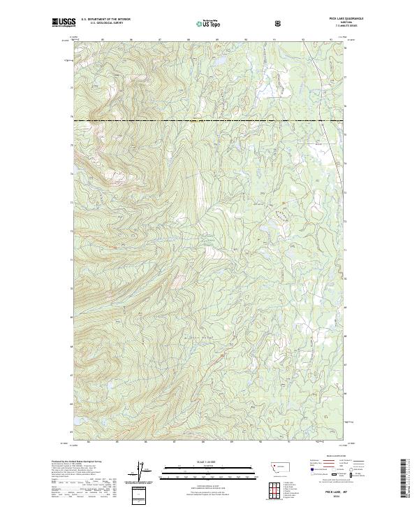
2024 Map of Peck Lake
USGS Topo · Published 2024About this map
The Mission Range dominates the western half of this quadrangle, much of it protected within the Mission Mountains Wilderness. This high-altitude landscape transitions into the Flathead National Forest as it slopes toward the Swan River valley in the east. The drainage network is complex, defined by the Jim Creek, Cold Creek, and Elk Creek systems that feed into the main river channel. Smaller bodies of water such as Peck Lake and Jim Lake are tucked into the drainages of the Mission Range.
Find a feature on this map
35 named features on this map. Tap any name to fly to it.
Don’t see what you’re looking for? This feature index may not catch every label — zoom into the map to look around manually.
Map Details
Editions of this 2024 Peck Lake Map
This is the sole edition of this map. No revisions or reprints were ever made.
Other maps of this area

1921 · Elbow Lake
USGS Topo · 1:125,000

1955 · Choteau
USGS Topo · 1:250,000

1957 · Choteau
USGS Topo · 1:250,000

1958 · Choteau
USGS Topo · 1:250,000

1962 · Choteau
USGS Topo · 1:250,000

1965 · Peck Lake
USGS Topo · 1:24,000

1965 · Condon
USGS Topo · 1:24,000

1965 · Swan Peak
USGS Topo · 1:24,000
1965 · Piper-Crow Pass
USGS Topo · 1:24,000
1965 · Cygnet Lake
USGS Topo · 1:24,000