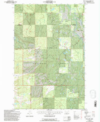
1994 Map of Peck Lake
USGS Topo · Published 1996About this map
The Swan River valley serves as a primary geographic corridor in this mid-1990s survey of the northern Rockies. Dividing the territory between Lake County and Missoula County, the terrain is defined by the protected acreage of the Flathead National Forest and the high peaks of the Mission Mountains Wilderness. A dense network of drainage systems, including Jim Creek, Cold Creek, and Condon Creek, feeds into the river from the steep western slopes.
Find a feature on this map
18 named features on this map. Tap any name to fly to it.
Don’t see what you’re looking for? This feature index may not catch every label — zoom into the map to look around manually.
Map Details
Editions of this 1994 Peck Lake Map
This is the sole edition of this map. No revisions or reprints were ever made.
Other maps of this area

1921 · Elbow Lake
USGS Topo · 1:125,000

1955 · Choteau
USGS Topo · 1:250,000

1957 · Choteau
USGS Topo · 1:250,000

1958 · Choteau
USGS Topo · 1:250,000

1962 · Choteau
USGS Topo · 1:250,000

1965 · Peck Lake
USGS Topo · 1:24,000

1965 · Condon
USGS Topo · 1:24,000

1965 · Swan Peak
USGS Topo · 1:24,000
1965 · Piper-Crow Pass
USGS Topo · 1:24,000
1965 · Cygnet Lake
USGS Topo · 1:24,000