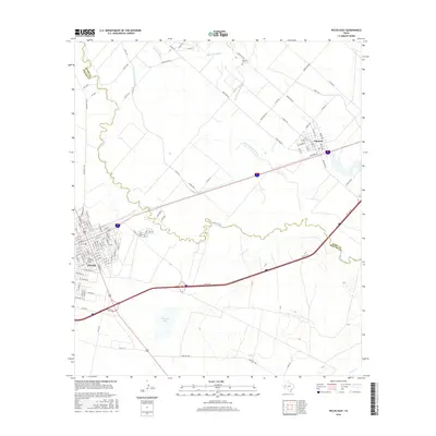
2016 Map of Pecos East
USGS Topo · Published 2016About this map
The Pecos River meanders across this West Texas landscape, forming a natural boundary between Ward and Reeves counties. On either side of the waterway, the neighboring communities of Pecos and Barstow appear connected by the modern corridor of Interstate 20 and the historical path of Railroad St. The area's agricultural heritage is etched into the terrain through an extensive network of irrigation infrastructure, including the Barstow Canal, Main Line Canal, and multiple laterals such as Lateral Number One.
Find a feature on this map
109 named features on this map. Tap any name to fly to it.
Don’t see what you’re looking for? This feature index may not catch every label — zoom into the map to look around manually.
Map Details
Editions of this 2016 Pecos East Map
This is the sole edition of this map. No revisions or reprints were ever made.
Other maps of this area

1921 · Toyah
USGS Topo · 1:125,000

1931 · Barstow
USGS Topo · 1:125,000

1954 · Pecos
USGS Topo · 1:250,000

1957 · Pecos
USGS Topo · 1:250,000

1961 · Soda Lake
USGS Topo · 1:24,000

1961 · Sand Lake
USGS Topo · 1:24,000

1963 · Old X Ranch
USGS Topo · 1:24,000

1963 · Quito Draw
USGS Topo · 1:24,000

1963 · Pecos East
USGS Topo · 1:24,000

1963 · Toyah Lake
USGS Topo · 1:24,000