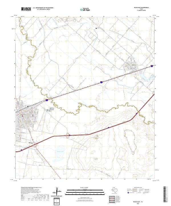
2022 Map of Pecos East
USGS Topo · Published 2022About this map
Pecos serves as the focal point of this Trans-Pecos landscape, where the grid of the town site meets the winding course of the Pecos River. The map highlights the town's administrative role with the Reeves County Courthouse and records several local burial sites, including the Old Pecos Cem and Santa Rosa Cem. Across the river to the northeast, Barstow appears as a distinct settlement, its local history tied closely to the irrigation networks represented by the Barstow Canal, Main Line Canal, and several lateral systems like Lateral Number One. These man-made waterways illustrate a long history of water management in an arid region, supporting agricultural efforts away from the main river channel. Large natural features such as Mosquito Lake and the drainage of Toyah Cr further define the terrain between these two West Texas communities.
Find a feature on this map
110 named features on this map. Tap any name to fly to it.
Don’t see what you’re looking for? This feature index may not catch every label — zoom into the map to look around manually.
Map Details
Editions of this 2022 Pecos East Map
This is the sole edition of this map. No revisions or reprints were ever made.
Other maps of this area

1921 · Toyah
USGS Topo · 1:125,000

1931 · Barstow
USGS Topo · 1:125,000

1954 · Pecos
USGS Topo · 1:250,000

1957 · Pecos
USGS Topo · 1:250,000

1961 · Soda Lake
USGS Topo · 1:24,000

1961 · Sand Lake
USGS Topo · 1:24,000

1963 · Old X Ranch
USGS Topo · 1:24,000

1963 · Quito Draw
USGS Topo · 1:24,000

1963 · Pecos East
USGS Topo · 1:24,000

1963 · Toyah Lake
USGS Topo · 1:24,000