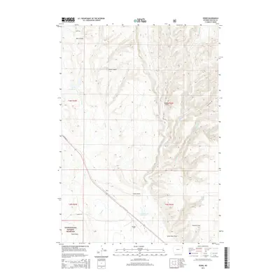
2015 Map of Pedro
USGS Topo · Published 2015About this map
US Highway 16 cuts diagonally through this corner of Weston County, passing the settlement of Pedro as it skirts the southern reaches of the Thunder Basin National Grassland. The landscape is defined by a dense network of seasonal drainages and named canyons, including Black Canyon, Coyote Canyon, and Crane Canyon. Water management is central to the area's utility, evidenced by several small impoundments such as the Y T Reservoir and the Bernard Howell Reservoir, which likely serve the ranching operations that characterize this part of the Wyoming plains. Near the southern border, Mondell Field and Home Ranch Draw indicate a history of local habitation and land use. The topography is further marked by the deep Sixmile Basin and several forks of Fourmile Creek, showing a rugged terrain where local roads like Dunham Rd and Seeley Rd navigate between the high ridges and watercourses.
Find a feature on this map
28 named features on this map. Tap any name to fly to it.
Don’t see what you’re looking for? This feature index may not catch every label — zoom into the map to look around manually.
Map Details
Editions of this 2015 Pedro Map
This is the sole edition of this map. No revisions or reprints were ever made.
Other maps of this area

1898 · Sundance
USGS Topo · 1:125,000

1899 · Newcastle
USGS Topo · 1:125,000

1901 · Newcastle
USGS Topo · 1:125,000

1902 · Sundance
USGS Topo · 1:125,000

1951 · Newcastle
USGS Topo · 1:24,000

1951 · Osage SE
USGS Topo · 1:24,000

1954 · Gillette
USGS Topo · 1:250,000

1955 · Newcastle
USGS Topo · 1:250,000

1955 · Gillette
USGS Topo · 1:250,000

1958 · Gillette
USGS Topo · 1:250,000